So what are we bloggers to do when we try to pass along news stories to an eager readership? We step up, form our own information community via the marvelous technology offered to us today. Question # 2: How do we manage to accomplish this feat? The answer will be the focus of this article, and which will, hopefully, inspire folks to reach out, to communicate with each other, and to form this body of valuable resources.
Years ago, when I was working on my Biology degree, I was fortunate enough to have as my professor/adviser, one of those types that thought outside the box. I had never met anyone like him; his genius lay not in what he knew personally, but in what information he could tap into and use to create a means of accomplishing the fullest education for his students. Dr. Jim Grove later became like family to me and to this day, I think of him more like a brother than a teacher. However, what he taught me, through demonstration, continues to benefit my life and the lives that I touch.
Jim showed me that the phrase, "no man is an island," is truer than it ever has been; there is simply so much information prevalent in our modern society that one person cannot contain it all. And as previously stated, the big news corporations live by a particular standard that is imposed upon their readers, leaving them less than fulfilled and satisfied. Therefore, it is up to the individual to form a web of resources in order to provide that information. Let's start with an example that occurred today.
Note this news blurb from Fox (Faux) News:
Alaska Volcano Sends Ash Plume Up to 15,000 Feet
Published December 29, 2011
| Associated Press
ANCHORAGE – A volcano in Alaska's Aleutian Islands sent up an ash cloud on Thursday that prompted scientists to increase the alert level for commercial aircraft traffic.
The Alaska Volcano Observatory said satellite images at 4:02 a.m. Alaska time showed Cleveland Volcano
had spewed ash 15,000 feet into the air in a cloud that moved
east-southeast. U.S. Geological Survey scientist-in-charge John Power
called it a small explosion.
"It's not expected to cause a disruption to big international air carriers," he said.
However, it was significant enough to raise
the alert level from yellow, representing elevated unrest, to orange,
representing an increased potential of eruption, or an eruption under
way with minor ash emissions or no emissions.
<SNIP>
source
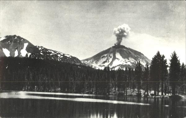
1st image (source)
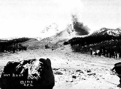
Second image (source)

How tough was that to accomplish? If it was any easier, I would be grasping images out of thin air. How did I know where to go to find these pictures? What are the steps or filters I use in order to gain my goal?
1. Of primary importance--check the volcano observatories for the most reliable/recent information/images. The 2nd image above was found at Alaska Volcano Observatory. The 1st was found via Google search, but NASA is responsible for this sat image. Remember that Google is your best friend; use the image search and you can easily tell which images are older and which are most recent. Also, use Google search within the parameters of the last day/week for information. Sometimes, being persistent and checking all you find brings results.
2. As everyone and his uncle has some sort of video recording device, YouTube is a great place to check for images. Use the same time frame as you used for Google and that should clear out the older posts. Also, look at Google Earth Blog's site; sometimes, within a very short time frame, a .kml file will be created and using Google Earth, one can get a better, larger view of the volcano.
3. Check local news/websites in the area surrounding the volcano; often the local newspaper is far more efficient and informative that the big guys in the industry. Again, Google is your friend; enter the search term, "newspapers for (name of city)." However, do look for evidence that the proper research has been done. For example, yesterday, one small news site erroneously stated that a certain volcano had erupted last year when in fact, it has been ten years (name, info, etc. withheld in order to avoid extreme embarrassment on non-stated party's part).
4. Watch the webcams. Although I am touching on the topic of technology and will go into details later, there are many places online where one can find a list of webcams. Erik Klemetti provides a list at his excellent Eruptions blog, and (I also suggest following him on Twitter) then, there are my own pages, where you can go to any place, anywhere in the world, any time of the day in order to see what's happening. Links are listed below. Once you know the "image location" of a cam (right clicking an image should give you that option), you can copy and paste it into a desktop client, like Yahoo's webcam widget that will allow you to add up to 200 locations per single cam. I duplicate and use 8 of them, as it's the easiest way for me not to miss an eruption. I simply program the cams to make copies of images every time the cams reload and save them to a folder so that I may look at them later. At the moment, I'm watching and snapping images of Tungurahua, Popocatepetl, and Galeras. These are the freshest images anyone can find on the net. Try it.
5. In real estate, the key to success may be "location, location, location," but in information outsourcing, it's people, people, people. Developing contacts is a must, and even though this may feel like a slower than snail mail process, hang with it; you'll make new friends, you'll learn a great deal, and you'll gain an information source that is priceless. But how, you ask? Twitter, Facebook, Google+, LinkedIn and even Flickr provide places for interaction to occur. I maintain 6 Twitter accounts, and all of them have to do with different interests, but without those accounts, my blog postings and my ability to learn would be severely hampered.
But the contacts I've made are priceless. Get to know photographers who shoot in the area of your interest (in this case, volcanoes), local volcano enthusiasts who you may have seen retweeted, regardless of country of origin (Google translator or Babelfish can make a huge difference in understanding, if you are not proficient in a foreign language), other bloggers who are like-minded, and Earth Science teachers. I especially like the latter, as I am a former teacher and still highly regard the profession.
And most of all, don't be just a taker; give back. SHARE your knowledge. Be a positive force in your world, as you never know who is reading your posts. Set the example.
If you have multiple Twitter accounts, or even if you use Facebook and Twitter, you'll need a host client where you can get up-to-the-second updates. Although there are other services, I prefer Yoono, which attaches to my Firefox browser and allows me to continue working without having to stop and hunt for for a link. I simply click over from one account to the next, read it out of the corner of my eye, and keep going. Having gone through grad school, I learned that shortcuts are the divine paths to having a life in addition to working your butt off.
6. Technology. Make use of the "junk" you may have received at Christmas, and in the midst of the entire fiasco, you may find that instead of junk, it becomes an essential. Smartphones, netbooks, laptops, and PC's use programs and apps that can expedite your geological journey. Think how best these items can serve your purpose. Plan your work, then work your plan.
7. Let's not forget books. Always a favorite source of mine, I've begun to use my Nook for the latest releases by my favorite authors. Formats include epub, mobi, Kindle, and pdf, to name a few. And if you look, you'd be surprised at the number of free geology books that are out there, ready to download. Of course, my desk will always look like someone left half a library on it, as I have many old standards to which I refer constantly, but once a nerd-always a nerd.
I hope you've enjoyed what information I have provided and I do hope it serves you well. If you should have any further questions, please tweet me @1roxxfoxx and I'll be glad to help. And believe me, if I don't know the answer, I'll know someone who will.
Best,
Lin Kerns
List of Internet Resources:
(Volcano Ovservatories List) http://www.geo.mtu.edu/~jaherric/Observatories.html
(NASA) http://earthobservatory.nasa.gov/
(Google Earth Blog)
http://www.gearthblog.com/blog/archives/2011/12/volcano_forms_a_new_island_in_the_r.html
(Erik Klemetti's Eruptions Blog)
http://www.wired.com/wiredscience/2011/12/and-the-2011-pliny-for-volcanic-event-of-the-year-goes-to/
(Vei8: Volcanoes of the World) http://vei8home.blogspot.com/
(Yoono) http://yoono.com/
(Service manuals for everything electronic) http://www.manualdepotweb.com/shop/


